INTEGRATED SPATIAL PLANNING AND ANALYSIS TO PRIORITIZE BIODIVERSITY CONSERVATION IN SRI LANKA
Date of commencement: January 2016
Date of completion: February 2017
Project partners: National Biodiversity Secretariat of Sri Lanka
Funding agency: Japan Biodiversity Fund (JBF) of the Secretariat of the Convention on Biological Diversity (SCBD)
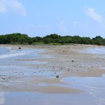
Sri Lanka is recognized as possessing globally important biodiversity by several yardsticks of measurement (Biodiversity A-Z, 2014)
THE PROJECT
The “Integrated Spatial Planning and Analysis to Prioritize Biodiversity Conservation in Sri Lanka” project was conducted by EFL in partnership with the National Biodiversity Secretariat (NBS) of Sri Lanka. Despite being an early signatory to the Convention on Biological Diversity (MoFE, 1999), Sri Lanka has only achieved 19% of the priority recommendations from the first National Biodiversity Strategic Action Plan (NBSAP) (Bandaratillake, 2014), attributed to the poor integration of targets and recommendations into plans, policies and programmes of the development sector agencies.
The objective of this project was to identify conservation priorities within the NBSAP vis-a-vis the Government of Sri Lanka’s socio-economic development plans, and to provide recommendations for the implementation of the same.
STRATEGY
Available data on biodiversity, socio-economic, and development were used to develop 16 maps depicting features of the landscape, conservation and developmental priorities. These maps include existing protected areas, proposed gaps in protected areas, forest areas important for erosion and flood control, habitat suitability and corridor models, as well as areas identified for commodity agriculture and large scale infrastructure.
FINDINGS
Spatial analysis tools were used to prioritize conservation targets for important biologically diverse areas, their vital habitats and watershed areas among other things.
Outputs indicate that more conservation attention is needed in the wet zone. Further to this, habitats around the forests within the wet zone were found to be suitable to support smaller endemic species, and should be included in the conservation strategy. In general, ecological connectivity in both the dry and wet zones need to be maintained and expanded.
Infrastructure and agricultural zones indicate the potential for severe land use conflicts, some of which include, the disruption of habitat connectivity, loss of wildlife habitat, large scale deforestation and threat of overlays with protected areas.
PROJECT OUTPUTS
Five targets were established under which multiple goals were achieved. Some of which include, the establishment of a national list of ecosystem types and species, implementation of the national ecosystem/habitat conservation plan by integrating it with development activities and private sector investments, establishment of an interactive web portal to create awareness on threatened species of Sri Lanka, developed guidelines to incorporate Biodiversity and Ecosystem Services (BES) values into regional/national biodiversity financing mechanisms.
Additionally, recommendations aimed at promoting stewardship and PES related conservation initiatives were presented. The spatial database and maps produced are meant to complement such recommendations put forth in the NBSAP 2016-2022.
CONCLUSION
One of the key aspects revealed in the analysis is the lack of synthesis between national development,
local development, and conservation goals, which in turn results in top-down, infrastructure-focused and
centrally-planned development being prioritized over the wellbeing and socio-economic security of
local communities, wildlife and the environment.
While the NBSAP identifies what has to be done to achieve the necessary targets, the spatial database provides a roadmap of where the interventions are needed. Both outputs are timely, especially since the national planning process to revise the existing plan and identification of major developments began in March 2016.
The spatial database developed will be deposited within the National Biodiversity Secretariat of Sri Lanka, and also be made available to other stakeholders so it can be updated, accessed, and used for planning and implementation of the NBSAP.
Additionally, the database created by this project will be introduced as a touchstone for national-scale priorities that should be considered and included at sub-national levels during the planning of projects.
This interactive web portal has been created as a platform to kick-start discussions and share knowledge on this subject.
PROJECT OUTCOMES
Apart from the main objectives, the JBF funded project has equally been effective and beneficial in influencing development planning and biodiversity conservation in Sri Lanka. In addition, the project has created many other networking opportunities for the EFL to share project findings with relevant parties. For example, the EFL Chairperson and science advisor Dr. Eric Wikramanayake was invited to take part in many workshops held at the Ministry of Mahaweli Development and Environment and National Physical Planning Department (NPPD) where he could not only talk more about the CBD project but, also elaborate on other work carried out by the EFL related to biodiversity conservation. Moreover, the findings of this project were presented at the 13th meeting of the Conference of Parties (CoP 13) in Cancun, Mexico in December 2016, an effective platform to manifest the outcomes of this project to industry experts. On the other hand, the maps developed throughout the project will be utilized in future on the EFL website to be accessible for all stakeholders and anyone else interested in future research on biodiversity conservation in Sri Lanka.
For your comments and experiences
PROJECT OUTPUTS