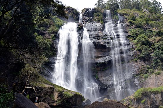
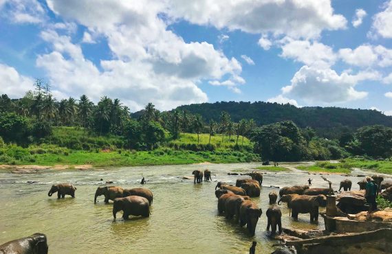
Maha Oya is one of the largest rivers in Sri Lanka, which flows 128 km across four provinces and five districts. It starts from Nawalapitiya, from the area of Aranayake and falls in to the Indian Ocean from Kochchikade, North of Negombo. More than 1.1 million of population lives by the river, harnessing myriad of benefits from the river for their subsistence and livelihood activities. The Maha Oya provides water for domestic and industrial needs of different communities living by the river. There are 14 National Water Supply and Drainage Board (NWSDB) water intakes along the Maha Oya, some of the important water users are Bandaranayake International Airport (BIA), Katunayake Export Processing Zone (KEPZ), Kegalle Urban Council, Negombo Municipal Council, Mawanella Pradeshiya Sabha and 04 other industrial parks. The downstream of the river is famous among environmentalists, tourists and bird watchers being one of the tourism hotspots of the country. Hence, continuous river flow and good health of the riverine environment is of vital importance in terms of socio-economic and environmental aspects.
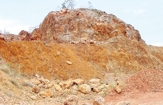
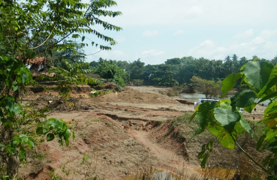
The river associated mineral extraction such as sand and clay mining is widespread in the midstream and downstream especially in Kurunegala, Puttalam and Gampaha districts, with river sand being one of the essential ingredients in the construction industry. The Maha Oya has become a well-known source of high quality river sand. The annual sand requirement of the country is nearly 8.5 million cubes in year as recorded in 2010 with an increase of 5-10% per annum. Quite a significant quantity of Sri Lanka’s fine sand requirement has been supplied from Maha Oya since 1970’s. With the free economic policies and subsequent boom in the construction industry, stresses on the Maha Oya as a source of sand has been gradually increasing over time. Since the late 1980’s, the sand mining in the Maha Oya and clay mining in the hinterland have been exacerbating, giving rise to a number of environmental and socio-economic problems. The most devastating impacts not only confine to the riverine environment, but also the coastal environment has been subject to severe degradation. The Maha Oya transports sand to nourish the coastline from Negombo to Chilaw.
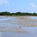
Excessive sand mining activities in the Maha Oya causes reduction of sand supply to the coastline, breaking the natural sand equilibrium of the beaches. This indiscriminate sand extraction from the river leads to lack of sand availability for replenishing the beaches which are naturally washed away by the wave action. The coastal stretch from Negombo to Chilaw has been identified as the most eroded coastline in Sri Lanka by the Coastal Zone Management Plan in 2006, of which 80-85% of the degradation is attributed to exacerbated sand mining in the Maha Oya. At certain places such as Katuneriya and Lansiagama, the erosion rate is 12-15m/year. Due to the coastal erosion in Wennappuwa and Nattandiya DS divisions, over 1,000 of families lost their properties over the span of a 20 year period giving rise to a number of adverse impacts including loss of homes and other properties, and loss of livelihoods. Some of these displaced communities have been living in temporarily built sheds for nearly 3 years since 2009. The Coast Conservation Department has spent millions of Rupees to stabilize the coast against ongoing erosion.
The river itself is subject to severe degradation due to river sand and clay mining, most devastating impacts include:
- River bank erosion and land degradation due to erosion and inland mining
- Lowering of the water table causing problems in water accessibility
- Salinity intrusion to the river and other fresh water systems due to lowered river bed and water table
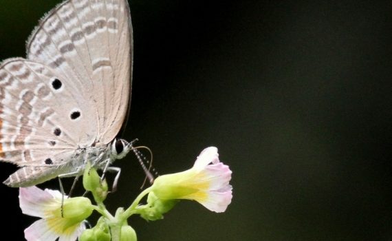
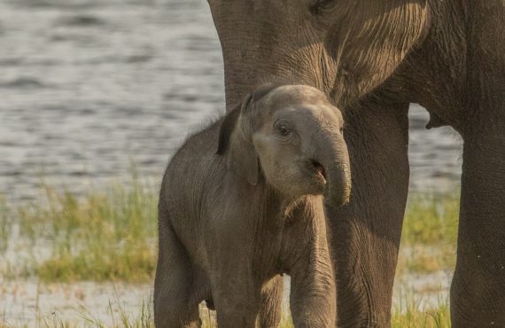
- Loss of biodiversity and associated impacts on tourism and recreational value of the river
- Impacts on the livelihoods and subsistence of the communities
There are more than 1,000 traditional miners along the Maha Oya River, but the engagement of the powerful business groups in this industry causes threats to their livelihoods. These business groups carry out illegal mining using heavy mechanical equipment such as long arm backhoes and motor boats which have been completely banned since 2004. Mechanized mining causes more damage to the riverine environment than traditional artisan mining, the extraction rate of the sand is far higher than that of artisan mining causing bank erosion and depletion of sand deposits.
A project implemented by Environmental Foundation Limited (EFL) in collaboration with the Geological Survey and Mines Bureau (GSMB) and Open University of Sri Lanka (OUSL) with funding of the Mangroves of the Future Initiative adopted an integrated approach in conservation of the riverine environment in order to increase the resilience of coastal and riverine communities. Under this project, maps developed on the distribution and area occupied by mined pits shows the level of degradation of the land in the hinterland of the river. A significant number of land owners along the river lost their lands either partially or completely due to erosion of river banks.

The change of land use and land degradation in the riverine environmental causes degradation of ecosystems impacting the provision of ecosystem goods and services to the communities who are dependent on them. The fish diversity and the abundance were impacted adversely jeopardizing the livelihood of freshwater fishermen.
Aggravating these conditions, untreated effluent discharge from several industries deteriorates the quality of the water in the Maha Oya preventing communities using water from the river. In Godigamuwa area only, more than 100 house owners were forced to abandon their domestic wells due to drying up or dig the existing wells further to access water. Salinity intrusion to the river has caused severe problems in treating this water at Bambukuliya Water Intake operated by NWSDB. In 1984, the NWSDB constructed a salinity barrier to avoid salinity intrusion through the upstream water intake with the expenditure of SLR 200 million. The bridge at Badalgama is under threat of collapse due to the eroding river banks in the vicinity. In addition to that, the road driven from Thoppuwa to Madampella is subject to erosion in the areas closer to river.
These impacts stimulate the thinking that value of sand extracted from the Maha Oya has a higher cost of production than the benefits it garners to the construction industry. Different institutions including Geological Survey and Mines Bureau, Department of Irrigation and Central Environmental Authority are responsible in addressing these issues, but these problems have been persisting for decades up to date due to inadequate attention by these institutions. It was suggested that these government stakeholders unite to develop and draft an implementable management plan to mitigate the impacts already taking place and prevent the detrimental impacts which would take place in the future. And subsequently in the year 2015, the Geological Survey and Mines Bureau drafted the Management Plan for Maha Oya with the participation of wider stakeholders along the river. The ongoing Maha Oya River Management Plan is expected to regularize mining activities, restore degraded areas, monitor illegal mining and effluent discharges whilst harvesting river sand in a sustainable manner. However, with the visits carried out to the downstream of the river in May 2016, it is highly questionable that the Management Plan is taking the right direction in conserving the riverine ecosystems for the future generation.
Disclaimer
Information in this article has been directly obtained from Department of Irrigation, Geological Survey and Mines Bureau, National Water Supply and Drainage Board and Roads Development Authority, Coast Conservation Department during the years of 2009-2011 for the implementation of the Mangroves for the Future funded project on “Increasing the Resilience of Coastal and Riverine Communities to Climate Change and Other Threats by Conserving the Ecosystems of the Maha Oya and Other Wetlands”.
[mk_button dimension=”three” size=”medium” outline_skin=”dark” bg_color=”#00c8d7″ text_color=”light” icon=”” url=”https://efl.lk/v2/wp-content/uploads/2016/06/Maha-Oya-Under-Threat.pdf” target=”_self” align=”left” id=”Buton ID” margin_top=”0″ margin_bottom=”15″]Download PDF[/mk_button]


No comments yet.